The Drowned Line and the Floating Vault
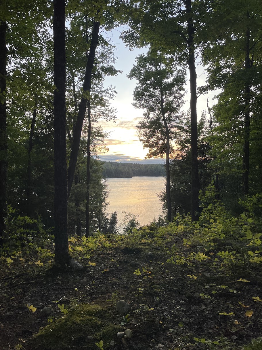
The clarity of the watershed can be deceptive. To look through the water is to see a record folded by timber extraction, flood control, peat, shoreline, and time. The surface may appear clean, but the edge holds the deeper account.
The Drowned Line
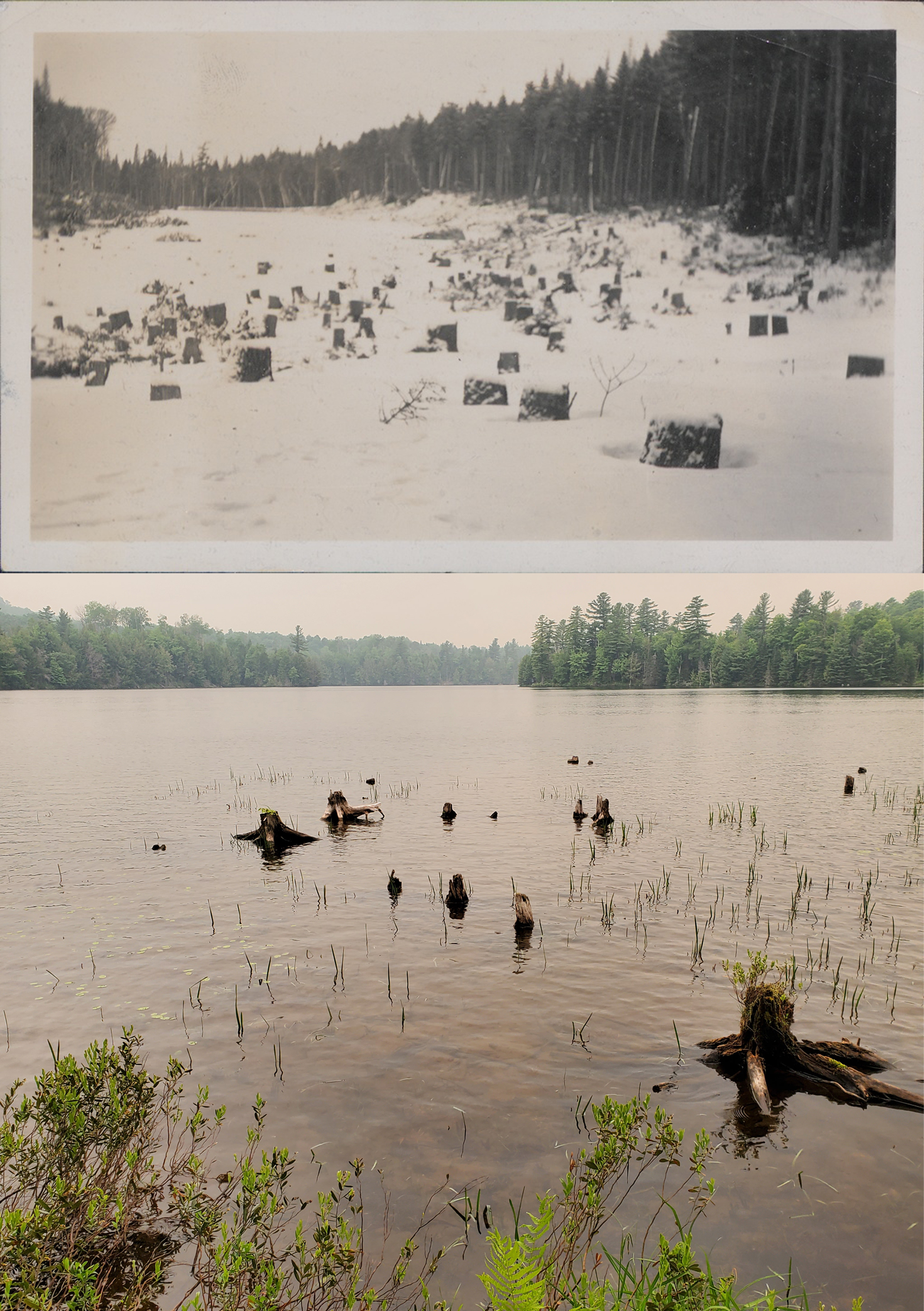
Closer to the surface, the remnants are modern enough to read by eye. Beneath the keel, scattered stumps mark a flooded contour. These are not accidental sinkers from a timber drive. They are rooted casualties of a deliberate water rise, left standing where they grew.
Before the modern basin was flooded in 1980 with the construction of the concrete dam, this was not one continuous pond surface. The basin held separate ponds, wetland channels, and a broad sphagnum peat system. The forest was cut to a predicted waterline. Then the water rose and stopped the clock. The old trees remained below the surface in the haphazard geometry of the original woods.
The elevation record gives scale to that change. Historical maps record older pond surfaces around 1,442 to 1,443 feet. Modern mapping and dam records place the present normal pool near the 1,450-foot contour. Read together, those records show a rise of roughly 7 to 8 feet. That rise drowned the former land bridge between basins and made the modern pond a different hydraulic body from the one shown on the older maps.
Margin Condition and Reinvestment
The drowned stumps do not only mark an old boundary. They now serve as hard structure inside the water: anchors for Spongilla lacustris, refuge for fish, shadow for edges, and a submerged framework where biological rebound can use the remains of disturbance.
Damage can become structure. Structure can become habitat. Habitat does not erase damage.
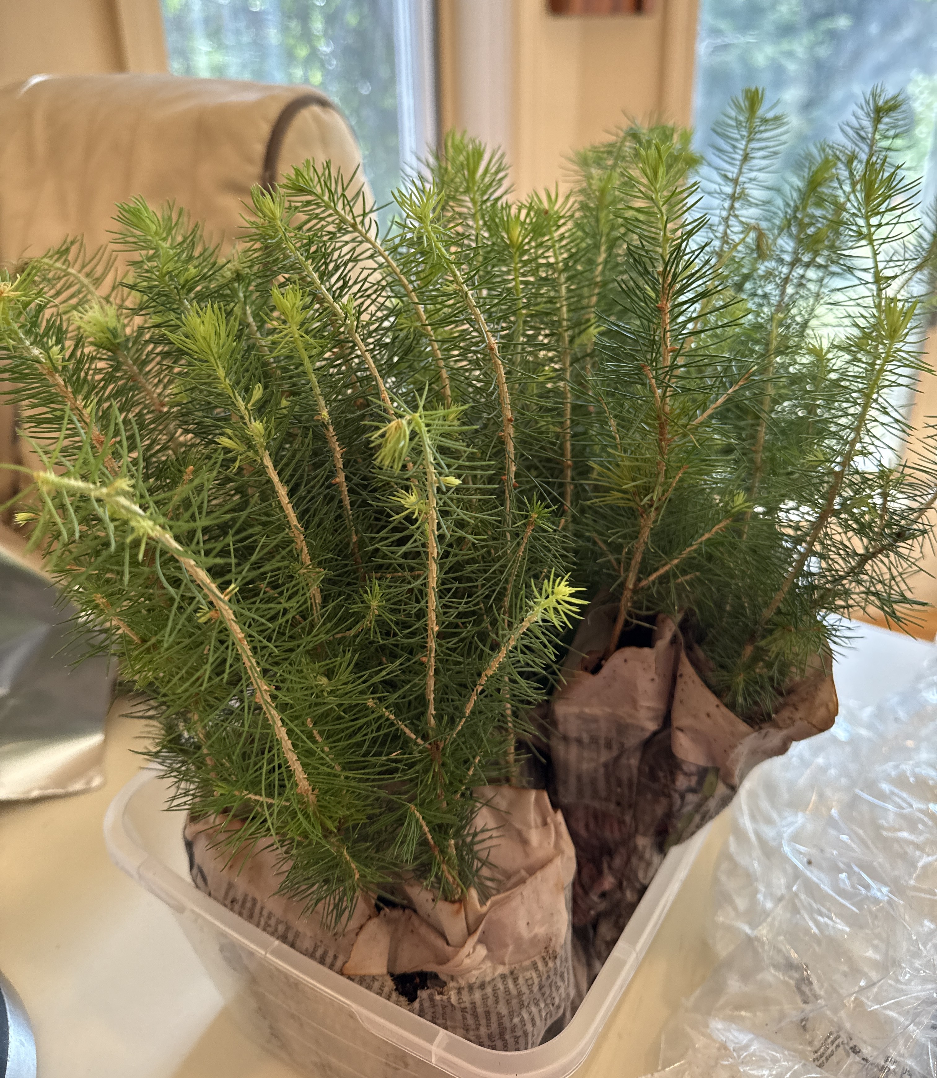
Along the working margin and higher ground, trees and shrubs have been planted into the open ground: hemlock, spruce, white pine, pitch pine, and other small stock meant to return shade, root, bank, cover, and future structure.
The work is not scenic improvement. It is the choice to let the margin thicken again instead of forcing the view open. The margin is not being restored to an original condition. That condition is not available. The old line has been cut, drowned, raised, and rewritten. The work now is to give the edge more life than exposure.
The Floating Vault
Beneath the visible margin is the slower, anaerobic record.
In 1984, operators used a backhoe and barge to cut navigation channels through floating peaty material near the northern outlet. By the time of that dredging, the 1980 dam had already raised the water, deepened and enlarged the ponds, and caused marshy deposits near the northern outlet to detach from the bottom and float.
During that dredging sequence, two dugout canoes were recovered from the disturbed peat system.
Both were made from conifer wood. Both were darkened by charring. Neither showed evidence of metal-tool cut marks. The authors who examined them concluded that the dugouts were almost certainly made by Indigenous artisans using fire and non-metallic tools.
The smaller dugout measured 3.75 meters and produced a radiocarbon age of 200 ± 30 years BP. Its calibrated results include a strongest seventeenth-century probability range, while the reported median age is AD 1767. The larger, Behemoth, dugout measured 6 meters and produced a radiocarbon age of 260 ± 30 years BP, with a most probable mid-seventeenth-century range and a median calibrated age of AD 1645.
Recovered during the same dredging sequence does not mean made together, used together, lost together, or originally rested together. The age difference argues against treating them as one event. The later damming and water rise further complicate the recovery context: the floating peat lifted, channels were cut, and the relation between artifact, mat, bottom, and shoreline had already been disturbed before the backhoe exposed them.
The peat did not have to preserve one event. It could have held separate episodes of use over a longer period, later brought into the same recovery zone by raised water, floating peat, and dredging.
That time spread changes how the place reads. The dugouts do not point to one isolated event only. They suggest a pond and wetland edge useful over generations, not a single accident preserved in peat.
The larger dugout does not need a separate myth placed over it. Its size is enough. The published record treats the scale of the boat and the weight of a water-soaked 6-meter dugout as evidence against simple through-travel. The larger craft points instead toward repeated use on location.
That shifts the human scale of the watershed.
The later record reads this water through extraction and ownership: logging, cutover edge, drowned timber, camp, preserve, sporting water, dam, stocked fishery, private holding, and development. Those layers are real, but they are not the beginning of human use here. The dugouts expose an older layer beneath them.
The area was already being read, used, crossed, tapped, worked, and manipulated before those later names were placed over it.
Indigenous people saw use here too: water to cross, fish to take, wetland edge to work, cover, approach, storage, hunting platform, seasonal return. The dugouts do not give the whole story. They do not give a village. They do not give a name. They do not give permission to decorate the page with borrowed ceremony.
They give land use.
A worked conifer trunk. Fire. Non-metallic tools. A pond small enough to question the scale of the larger craft. A wetland edge able to preserve it. A water body used enough that a heavy dugout could belong there. Indigenous presence in this record is not atmosphere. It is material practice held in wood, water, peat, and weight.
The modern pond holds raised water, drowned stumps, floating peat, and a recovery zone disturbed by dredging. The dugouts do not settle the history of the place. They make the older use harder to deny.
Dugout data and recovery details are drawn from Stager, Fadden, and Wolff’s Dugout Canoes from Lakes of the Adirondack Uplands.